- Sections :
- Crime & Public Safety
- Restaurants & Food
- Sports
- More
Categories
OAK RIDGE NORTH, Texas - Oak Ridge North questions and answers regarding Robinson... What is the issue on Robinson Road?
Questions and answers about the future of Robinson Road.
The answer is twofold: regional growth and traffic. Robinson Road is the eastbound arterial extending from the major intersection of Interstate 45 and Woodlands Parkway. When Woodlands Parkway overpass was constructed it was designed by TxDOT to meet the needs of the development in The Woodlands. TxDOT did little to accommodate future development to the east. It was not anticipated that the area east of I-45 would grow as quickly as it has. Imperial Oaks began development in the 1990’s and has matured to nearly 4,000 homes, with new developments continuing to emerge. This area has the potential to exceed 15,000 residences. The only corridor originally constructed to access that particular area was Rayford Road. Rayford Road has proven painfully inadequate to accommodate the growth. Robinson Road became the only other through street to I-45, when the County connected it to the Imperial Oaks development. It is, in fact, the most direct route to The Woodlands jobs, shopping, and entertainment. Robinson Road currently carries more than 16,000 trips a day on a two lane road only constructed for local residential traffic. The traffic count decreases to 10,000 trips a day east of the railroad. That means that the Robinson Road/Hanna Road intersection carries the biggest burden. It is currently a double three-way stop, with one at-grade crossing of the heavily utilized Union Pacific railroad corridor. Traffic numbers are expected double, then triple as growth continues into the future (see population sidebar).
What is the proposed plan to alleviate the issue?
The South County Mobility Plan (SCMP) engineering studies indicate that a four lane road with a turning lane is the best long term solution for the region. There would also be signalization at Hanna and Robinson Road. The City Council has considered a landscaped median instead of a turning lane to enhance the road and try to preserve the look of the community.
What if the City leaves Robinson Road as it is, and does nothing to accommodate the traffic?
Currently, the only options to access the southeast region of the county are Robinson and Rayford. The SCMP traffic studies provide data showing that Robinson Road traffic will double in the near future. The same traffic studies predict this increase even if improvements are made to Rayford Road. If nothing is done, the traffic studies point towards an increase in congestion and an expansion of the volume of traffic into other parts of the City. Local traffic will be impacted as motorists seek alternate routes. At this time, more than 2,000 cars a week detour off Robinson Road into the neighborhoods south of Robinson Road. This number can be expected to increase in the same proportions as Robinson Road traffic. Our residents are already experiencing the dangerous consequences of this traffic.
Have there been previous attempts to address the Robinson Road traffic issues?
Yes. Robinson Road has been included in the Houston Galveston Area Council’s (H-GAC) Regional Transportation Plan for about 10 years, and is included in the 2040 Plan. This makes the project eligible to compete for state funding when there is a call for projects, if the City or County has the ability to produce a 20% match. State funded projects must compete with all projects in the 13 county region (see sidebar on H-GAC). Locally there have been at least two attempts to address the road. In 2004, a University of Texas at Arlington study commissioned by the City said, “With the increase in traffic on Robinson Road, the City should look at widening the road to provide for increased traffic that will be passing in the future and to reduce the nuisance value of traffic passing through the City by channeling the traffic [along Robinson Road.]” The study specifically recommends that the road be realigned and widened to four lanes. Traffic was raised as an issue by residents during the community assessment through the Entergy Team City process in 2003 and 2006. The need to address Robinson Road traffic issues resurfaced in the City’s 2013 Comprehensive Plan (see sidebar) tied as one of our citizens’ top issues.
Why weren’t these plans put in place at the time?
Most likely these attempts died for lack of funding opportunities. Survey respondents to the Entergy Team City assessments and the current Comprehensive Plan indicated residents’ frustration that past planning never developed into projects that addressed the issues and the desires of the community. This City Council has committed to the 2013 Comprehensive Plan not gathering dust on a shelf. Through strong budget management over the past five years, investing in economic development efforts resulting in both increased property tax revenue from commercial property and increased sales tax revenue, and developing working relationships with our community partners at the county, HGAC, The Woodlands and Shenandoah, the Council now has the opportunity to participate in funding the improvements our citizens have long requested.
What is the South County Mobility Plan (SCMP)?
Montgomery County Precinct Three Commissioner James Noack recognized the problems growth created for mobility in South County. He undertook to address the issues of mobility and included all of the stakeholders in South County including Oak Ridge North, Shenandoah, The Woodlands Township, and representation from communities east of I- 45. The study was funded by H-GAC and all participating stakeholders. The City of Oak Ridge North contributed $25,000 and participated in all sessions. This group took a full year to study the traffic and develop possible solutions. Public hearings were held on both sides of the freeway, including one at Oak Ridge Baptist Church. The result is a Mobility Plan for the region that takes us years into the future. The Mobility Study is available online at montgomerycountymobility.com.
How does Oak Ridge North fit into the Mobility Plan?
The biggest problem identified in all of South Montgomery County was the lack of mobility through the region east of I- 45. Rayford Road and Robinson Road were deemed as the roads needing immediate attention. The Robinson Road/ Hanna Road intersection and the railway crossing were graded an F in the Mobility Study. The Woodlands Parkway overpass, which is in the city limits of Oak Ridge North, is also identified as a critical short term project. The SCMP also includes suggestions for future roads to improve both east/west travel and north/south travel, to better disperse the traffic over various roads for future growth. Some of these minor north/south roads are in the Oak Ridge North extraterritorial jurisdiction and may become part of a future thoroughfare plan for the City. One of the highest priority projects, though not in the City’s ETJ, is the Tamina Road/Main Street/Sleepy Hollow route. Improvement of this road would provide future relief for east west travel, but does not alleviate the need for four lanes on Robinson Road.
Why was Robinson Road included in the failed 2015 Montgomery County Road Bond package if it is a city street?
Because the SCMP study pointed out the greatest need for improved mobility was east of I-45, Robinson Road was recognized as a regional road important to mobility throughout the area. It became apparent that it was not a problem that could be solved through the limited resources available to our small city and should be addressed by a joint effort of the city and county. The Mobility Study Committee and Precinct 3 Commissioner Noack, and the Bond Committee, all recommended that Rayford Road and Robinson Road be included in the bond. This was the first opportunity the city has had in its history to receive help from the county for any improvements to Robinson Road. The bond package included $8 million for construction. Previously the county had entered an interlocal agreement with the city to share cost of engineering for Robinson Road. If passed, and Robinson Road was approved as a project, the City would have been responsible for acquisition of any additional right-of-way for the proposed improvements. The City already owns about one quarter mile of the area where additional right-of-way may be required. The City also created a Tax Increment Reinvestment Zone (TIRZ) that, if joined by the County, could be a resource for purchasing additional needed right-of-way in the future.
Why is a proposed four lane road and realignment required?
The H-GAC regional traffic demand model used in the South County Mobility Plan (SCMP) to forecast future street volumes graded Robinson Road as an “F,” in terms of the average time of delay through the Hanna Road intersection. According to the forecast, Robinson Road needs a minimum of four lanes to accommodate current and future growth. Long-range scenarios, which included developing a grid of roadway networks east of I-45 showed a slight reduction of future traffic on Robinson Road; however, Robinson Road would still need a minimum of a four lanes. The realignment would accomplish several goals: 1) It would eliminate one of the two intersections that traffic has to go through in the east-west direction, therefore decreasing vehicle delays by approximately half. 2) It would improve traffic operations across the Union Pacific railroad crossing by converting turning movements into straight movements, and therefore making it easier for vehicles to get across the tracks with improved visibility, queuing storage, and less delay when turning in close proximity to the tracks. This key east-west road is one of only three roads, along with Tamina and Rayford that provides access to I-45. The realignment addresses mobility issues east of Oak Ridge North.
Will the funneling back down to a two lane road east of the railroad cause substantial backup of traffic?
The major cause of gridlock on Robinson Road is the double three way intersection at Hanna Road. This intersection carries 16,000 trips a day. It eases down to 10,000 trips a day east of the railroad tracks. The tapering of the road will cause some short-term slowing of traffic, but it is not expected to be as impactful as the current situation. The proposed long-term solution from the SCMP is to make Robinson Road four lanes until it reaches a proposed split where it will continue east to Townsen (future) and south to the four lanes of Imperial Oaks Drive. The City’s plans for a Tax Increment Reinvestment Zone in the ETJ could help facilitate that possibility in the future.
Was the realignment and widening the only option studied?
No. Other options were considered. The best “engineering solution” included a four lane widening and grade separation (overpass) straight over the railroad tracks, and then a realignment bending south back to tie into the existing alignment of Robinson Road east, or a realignment through to the existing crossing with a grade separation (overpass). Both overpasses require one half mile ramping on both sides of the railroad tracks to achieve the required elevation over the railroad. The approximate tie-in locations would be one-half mile west on Robinson at the Water Plant and one-half mile east to the new Fire Station. This extensive ramping would virtually destroy Robinson Road (residences and businesses) as we know it today. The cost was also prohibitive. The project, as included in the Mobility Study had an estimated construction cost of $8M. Either overpass solution would exceed $20M. The City demanded a more community friendly solution to realign to the south, removing the double threeway intersections, but still crossing the railroad at grade as it is today.
Why not move the railroad crossing north and avoid the realignment of the road?
There is a private crossing already in existence just north of Robinson Road. Only several hundred feet north is another, the Chateau Woods public crossing. Railroad policies for safety would not allow for moving a railroad crossing closer to an existing private crossing, and an existing public crossing (Chateau Woods). Even if these obstacles could be negotiated with the railroad, the cost of a new crossing with signalization is significant. It also would require ramping up to a new at grade crossing. The railroad sits approximately eight feet above Hanna Road at Robinson Road. Ramping will destroy usage of a certain amount of property to both the east and west of Robinson Road. This option also includes building a longer span of road over an existing drainage ditch.
The Comprehensive Plan suggested a three lane counter flow. Is this option being considered?
The Mobility Study concluded that the three lane counter flow option would do little to alleviate the traffic congestion, and there were substantial issues with aligning a facility with a large urban interchange such as the Woodlands Parkway overpass. However, the City is revisiting this option.
Can Robinson Road traffic be addressed without impacting residents and businesses?
There are no “all good” options. The City has been pursuing the best option with the least impact to residents and businesses. Where there are impacts, the City plans to work closely with residents and businesses to mitigate the issues.
If Robinson Road is widened to four lanes, will residents of the 13 homes on Robinson Road be forced to leave and their homes demolished?
No. If the project were approved and funded, the City, by state law, can only purchase the right-of-way needed to accomplish the widening and realignment. Most of the homes on Robinson Road, if the road were widened, would lose several feet of front yard. There may be three to six homes that sit very close to the current right-of-way that would be rendered non-viable for residential use. If that is the case, those owners would be offered a fair market value for the homes. They would likely have the option of retaining the land, or being compensated for the land as well as the home. Currently, the existing City right-of-way on Robinson Road already extends 10 to 15 feet south of the paved curb onto the front yards.
Will residents on Wickwood lose portions of their backyards?
No. There is no physical impact on the properties on Wickwood from the widening of Robinson Road.
Will the Oak Ridge Baptist Reformed Church and School be impacted?
The most critical potential impact on non-residential property is to the school and church. Most realignment options put the road through the front sanctuary. If the project should be approved and funded, the church would receive fair market value for their property.
Will the current City Hall be impacted?
Most realignment options put the road through the back lot of City Hall. The public works maintenance and equipment buildings would need to be relocated, and the old house on the property would be removed. There would be some adaptions made to City Hall to accommodate parking and a new front entry facing the new road.
Has the City purchased property for a new City Hall?
The City purchased the property at 27425 Robinson Road, across from the current City Hall, and removed the existing house. This property is available for a public purpose that has not yet been determined. It has been discussed as a possible future City Hall if deemed necessary. Other possible uses are for public works or police. The current City Hall is at capacity.
Is Robinson Road being widened and realigned to accommodate a Town Center?
No. The traffic on Robinson Road has been an issue for decades. The concept of a town center, or Plaza District as it is now zoned, first surfaced in 1997 in the Oak Ridge North Open Space Master Plan, as the Downtown Commercial Zone. This plan was developed with the city Planning Board and Texas A&M University. The concept was also included in a University Texas at Arlington study in 2004. It also resurfaced during Entergy Texas Team City community assessments in 2003 and 2006, calling for the City to investigate the possibility of a Town Center. The idea of a town center was brought up by residents again in 2013 during the latest Comprehensive Plan process.
What is the Plaza District?
The Council voted to create Plaza District zoning, to designate an area for a future town center as requested in the multiple studies cited, and to protect the area from commercial development that might be detrimental to our community and existing businesses. Previous zoning allowed for redevelopment as industrial property which was not community friendly. The potential realignment of Robinson Road to alleviate traffic is compatible with Plaza District zoning.
Is a Plaza District being developed?
No. The land in the Plaza District is held privately, by multiple landowners, with the exception of City Hall property and the county-owned Community Center. There has been interest shown by developers for the concept, but The 2040 Regional Transportation Plan (RTP) The 2040 RTP, managed by the H-GAC, provides a responsible guide for maintaining and improving the current transportation system and identifies priority transportation investments. The 2040 RTP is the latest update to a continuous planning process involving the eight central counties of the thirteen-county HoustonGalveston Area Council (H -GAC) region. The recommended investments in this plan total approximately $75 billion (in current dollars). The investment priorities in the 2040 RTP are based on conservative estimates of revenues available over the next 25 years. These investments are key steps toward realization of the vision plan. no land has been purchased and no plan has been presented to the City.
Why hasn’t the City or County installed signals at Robinson Road and Hanna?
Signalization of Robinson Road at Hanna requires coordination with the Union Pacific Railroad (UP). The UP standards would require a complete rebuilding of the railroad crossing and computerized coordination with the railroad. These standards are difficult to achieve with the existing configuration and expected to cost over $500,000. The proposed realignment and widening would address these requirements and would include signalization.
Can the City close Robinson Road to through traffic?
Robinson Road is a public street and cannot be closed to the public.
Why shouldn’t we leave Robinson Road as it is to be a deterrent for “pass-through” traffic moving through Oak Ridge North to destinations in The Woodlands or Imperial Oaks?
At this time, more than 2,000 cars a week detour off of Robinson Road into the neighborhoods south of Robinson Road. This number can be expected to increase in the same proportions as Robinson Road traffic. Our residents are already experiencing the dangerous consequences of this traffic with motorists traveling at higher than posted speeds in our neighborhoods. In addition, the residents and businesses fronting Robinson Road also experience dangerous traffic situations while entering or exiting their property during peak hours.
Can the City place stop signs on Robinson Road?
There is specific criteria for stop signs established by the State of Texas Manual on Uniform Traffic Control Devices (MUTCD). A warrant study is required to determine if an intersection meets the required warrants for stop signs. Per the MUTCD, a stop sign warrant study looks at traffic volumes on each street of the intersection, the wait time (delay), history of accidents, speed, and pedestrian counts. The MUTCD specifically states that “stop signs should not be used for speed control”, and “stop signs should not be installed on the higher volume roadway unless justified by an engineering study”.
Can the City place speed bumps on Robinson Road?
Speed bumps are not designed to control traffic volume, but to address speeding. There is no record of a speeding issue on Robinson Road.
When does the county expect to improve the Woodlands Parkway overpass?
In January 2015 the Precinct 3 Commissioner James Noack submitted the Woodlands Parkway overpass, which is located in Oak Ridge North city limits, for the H-GAC Transportation Improvement Program current projects. The submittal calls for a Single Point Urban Interchange (SPUI) that will address the movement issues on the overpass for several years into the future. The project will compete with all other submittals for the 13 county H-GAC region. TxDOT has submitted a letter of support for a SPUI at this location. A completed SPUI (see sidebar) anticipates some improvement to Robinson Road to completely address the flow of traffic on and off the overpass. If it is accepted as a project, construction would not likely begin before 2020.
Comments •

More From: (12990)

Nonprofit organization LookUp celebrates first anniversary

The Texas Department of Family Protective Services seeks applications for the new Partners for Children and Families Committee

Acorn Manor gets a Christmas visit from Santa AND Elvis

OPINION: Addendum to Candidate Analysis for The Woodlands Township Board Election – Shelley Sekula-Gibbs

Texas Autism Academy Board of Directors Welcomes Dr. Montisha Hines-Goosby LMSW

Woodlands Symphony to perform Mussorgsky, Gershwin, and Ravel
The Signorelli Company and First America Homes Commit to Building a Home for Charity

Lawgical Workspace, a workspace for legal professionals, has opened in The Woodlands
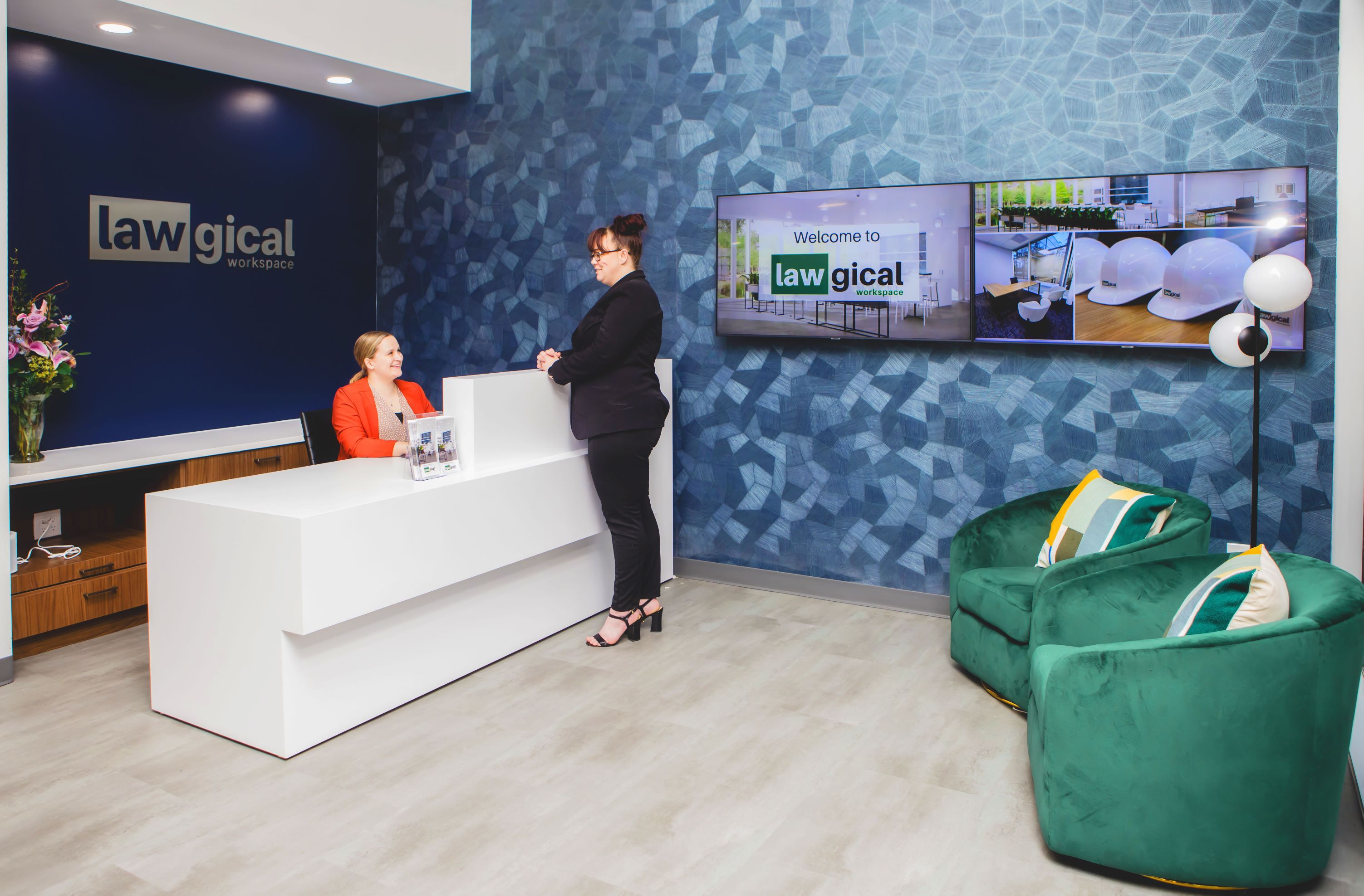
Lawgical Workspace, a workspace for legal professionals, has opened in The Woodlands

The Woodlands Resident Dr. Stephen C. Head Named a 2024 Lamar University Distinguished Alumnus
Land Preparation Begins for Regionally Transformative Development Led by The Woodlands-Based Company

Johnson Development North Communities to Showcase 190+ Homes for ‘best of the ‘burbs’ Tour