- Sections :
- Crime & Public Safety
- Restaurants & Food
- Sports
- More
Categories
Quick Overview
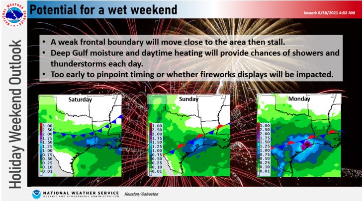
A weak frontal boundary will move close to the area then stall. Deep Gulf moisture and daytime heating will provide chances of showers and thunderstorms each day. It is too early to pinpoint timing or whether firework displays will be impacted.
Through Friday Night
As surface high pressure sags southward thru the Midwest & Plains, a
diffuse frontal boundary will sag closer to ne parts of the CWA
during the day Fri and will likely serve as a focus for shra/tstm
development later in the afternoon. Some of the HREF members take
some of this activity as far south as the I-10 corridor toward early
evening. Too early to say, but will need to keep an eye on things
considering seabreeze may be up in that general vicinity by that
time and possibly provide some interactions/collisions. Regardless,
elevated moisture levels pooled ahead of this boundary will remain a thorn in our side over the weekend...
Saturday Through Thursday...
A wet period is in store for Southeast Texas this weekend and
continuing into the middle of part of next week as a weak front
sags southward and stalls across central portions of the forecast
area on Saturday. Precipitable Water (PW) values increase to
around 2.4 inches in the vicinity of the weak boundary by
Saturday, which is well above normal and highlights the
possibility of locally heavy rainfall. Although PW values
gradually decrease some early next week, they remain around or
above 2 inches through next Wednesday.
Comments •

More From: (16496)
Texas Workforce Commission Reemployment Program receives national award
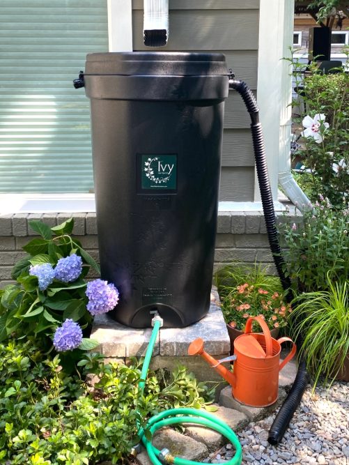
LSGCD is offering discounted rainwater harvesting kits for Rain for Tomorrow Conservation Initiative
Texas voters to decide on a combined 23 non-binding advisory questions in the March 3 primaries

Bob Harvey responds to 'false online claims,' reaffirms commitment to Precinct 2 voters

Shot Through the Heart - The Crooks to Blame. Crooks Give Love a Bad Name.

Nick’s Local Eats Celebrates 2025 Year End Awards

Texas Workforce Commission Welcomes New Executive Director Steve Pier

Conroe EDC Praises Hospitality, Generosity of Joe's Italian Restaurant's Holiday Meal Distribution

For the 70th year, NORAD will track Santa for your kiddos this Christmas Eve

Building Confidence Through Structure

A Lifetime of Accountability: Offender to Serve 75-Year Day-for-Day Sentence

Texas Pink Playbook Hosts Sold-Out Elvis Presley–Themed Event as It Emerges as One of Texas’ Fastest
Related News: Weather

Monday's Weather Update: Normal operations resume on Tuesday

Saturday's Weather Update: The Woodlands Express Bus will not operate on Monday
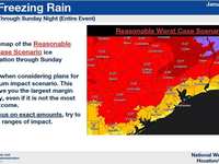
Montgomery County Issues Winter Weather Alert as Freezing Conditions Intensify

Red Cross offers tips to prevent pipes from freezing and ways to thaw them if frozen
