- Sections :
- Crime & Public Safety
- Restaurants & Food
- Sports
- More
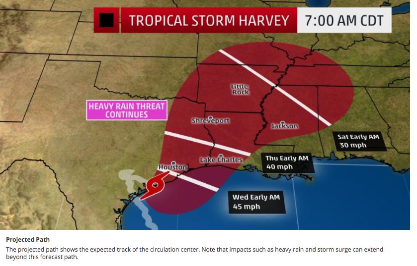
THE WOODLANDS, Texas -- The rain stopped for a short while this morning, this by no means puts us in the clear.
We are still expected to receive an additional rainfall amount between 12 and 25 inches
throughout the rest of the week. Overnight most of the county received just under 4
inches of rain.
The grounds are saturated, rivers and creeks continue to swell. Areas that flooded in
1994 will be inundated with water again. If you are in a low lying area, prone to flooding
you need to get to higher ground now. We have several Red Cross Shelters open and
receiving evacuees. If you receive a message on your mobile device to evacuate do so
immediately.
We currently have 4 shelters open/ 1 shelter in Montgomery County set up by Harris
County accepting both Montgomery County and Harris County Evacuees:
St. Simon and Jude
26777 Glen Loch Road
Spring, TX 77381
Bull Sallas Park
21679 McCleskey Road
New Caney, TX 77357
Magnolia High School
14350 FM 1488,
Magnolia, TX 77354
Under and Over Fellowship
600 South Frasier Street
Conroe TX 77301
College Park Highschool
3701 College Park Drive
The Woodlands TX
Harris County Shelter:
The Church Project
295 Sawdust Rd
The Woodlands TX
Watches and warnings remain in effect for Montgomery County:
Flash Flood Watch until August 30, 07:00pm
Flash Flood Warning until August 28, 12:45pm
We are out of high water barricades. Do not take it for granted that if there isn’t a
barricade that the road is safe to drive over. Motorists should use extreme caution when driving as some flooded or damaged roads may not be barricaded until we can secure more barricades. Flowing water on roadways can easily sweep a vehicle off the road. If you can stay at home, please do, do not drive unless you absolutely must.
Please do not go out sightseeing. Turn around Don’t Drown.
Current river forecast:
The West Fork of the San Jacinto near Conroe is currently in major flood stage at
119.84 ft. and is forecast to crest Tuesday afternoon in major flood stage at
123.8 ft.
The East Fork of the San Jacinto near New Caney is currently in major flood
stage at 70.33 ft. and is forecast to crest Wednesday night in major flood stage at
73.2 ft.
Spring Creek near Spring is currently in major flood stage at 106.7 ft. and is
forecast to crest late tomorrow night in major flood stage at 113.2 ft.
Spring Creek at Tomball is currently cresting at 166.7 ft.
Peach Creek near Splendora is currently in major flood stage at 23.69 ft. and is
forecast to crest tomorrow morning in major flood stage at 25.7 ft.
Caney Creek near Splendora is currently at 22.62 feet and is forecast to crest
tomorrow morning in major flood stage at 24.6ft.
The West Fork of the San Jacinto near Porter is currently at minor flood stage at
82.39 feet and is forecast to crest Tuesday night in major flood stage at 97ft.