- Sections :
- Crime & Public Safety
- Restaurants & Food
- Sports
- More
Categories
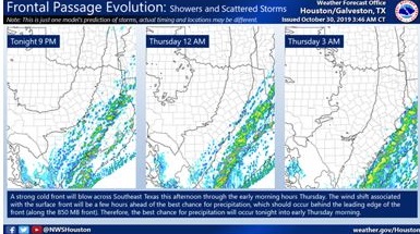
MONTGOMERY COUNTY, TX -- The wind shift associated with the strong cold front will push across the region this afternoon and into the early evening hours. This wind shift should reach the coast between 2 to 4 PM this afternoon. Showers and thunderstorms will be possible along the leading edge of the front. This should be the first round of precipitation, with the main hazards being gusty winds, frequent lighting, and localized heavy downpours.
A second round of precipitation should develop and push across Southeast Texas this evening into the early evening hours. This round of precipitation will bring additional rainfall in the way of locally heavy downpours. The system should be fast moving, and therefore not anticipating any flash flooding concerns. However, with the recent rains and previously saturated soils: citizens should be alert for the possibility of trees falling as the system moves through our area. Strong northerly winds are expected in this systems wake which will cause chilly conditions. Temperatures are expected to bottom out in the 30s to mid40s, with wind chills in the mid-20s to 30s, on Thursday and Friday morning.
The Montgomery County Office of Homeland Security and Emergency Management will continue to monitor the upcoming weather situation and send updates as conditions change.
Comments •

More From: (16540)

Texas voters to head back to the polls on May 26 to decide primary runoff elections
Texas Workforce Commission Reemployment Program receives national award
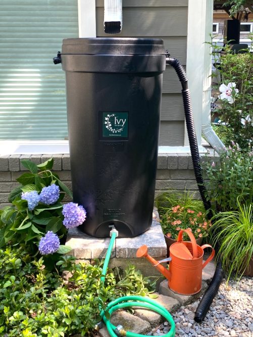
LSGCD is offering discounted rainwater harvesting kits for Rain for Tomorrow Conservation Initiative
Texas voters to decide on a combined 23 non-binding advisory questions in the March 3 primaries

Bob Harvey responds to 'false online claims,' reaffirms commitment to Precinct 2 voters

Shot Through the Heart - The Crooks to Blame. Crooks Give Love a Bad Name.

Nick’s Local Eats Celebrates 2025 Year End Awards

Texas Workforce Commission Welcomes New Executive Director Steve Pier

Conroe EDC Praises Hospitality, Generosity of Joe's Italian Restaurant's Holiday Meal Distribution

For the 70th year, NORAD will track Santa for your kiddos this Christmas Eve

Building Confidence Through Structure

Texas Pink Playbook Hosts Sold-Out Elvis Presley–Themed Event as It Emerges as One of Texas’ Fastest