- Sections :
- Crime & Public Safety
- Restaurants & Food
- Sports
- More
Categories
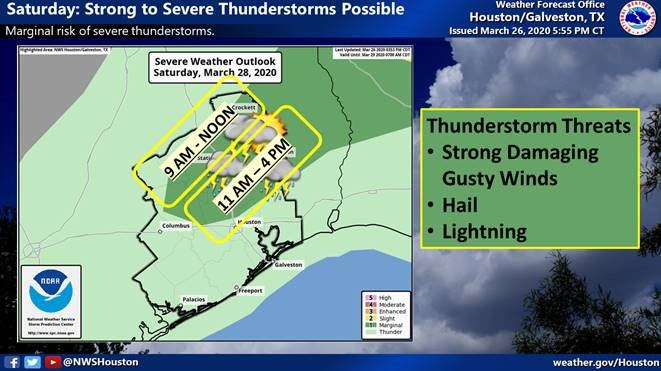
THE WOODLANDS, TX -- The Montgomery County area will see strong to severe thunderstorms tomorrow between 11AM – 4PM due to a weak cold front moving through the area Saturday. A strong cap of warm air aloft will hamper the development of thunderstorms over the area and especially over the southern portions of the area.
Mild and pleasant weather follows Saturday night through Sunday. A warm front moves back north into the region Sunday night leading to an increasing chances for storms again on Monday. The heavier rainfall is more likely to occur in Northeast Texas with another cold front pushing south into Southeast Texas late Monday into Tuesday. Although the rainfall in Southeast Texas is not expected to be heavy the main stem rivers are more likely to see rises as the runoff arrives mid-week and beyond. Here is a graphic from the West Gulf River Forecast Center highlighting these impacts.
To receive emergency alerts to your phone or email from Montgomery County Office of Emergency Management, register at http://www.mc911.org/page/ecd.AlertMCTX . When you are creating your profile, you must check the box next to Share my Smart911 Profile with TX-Montgomery-County-911 to support emergency preparedness.
Stay informed and monitor conditions for Montgomery County and the surrounding area on the Office of Homeland Security and Emergency Management website www.mctxoem.org, Facebook, or twitter, NOAA Weather Radio, KStar 99.7FM.
The Montgomery County Office of Homeland Security and Emergency Management will continue to monitor the weather situation and provide updates as we receive them.
Comments •

More From: (16564)

Texas voters to head back to the polls on May 26 to decide primary runoff elections
Texas Workforce Commission Reemployment Program receives national award
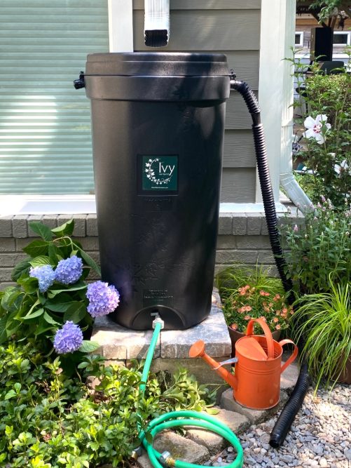
LSGCD is offering discounted rainwater harvesting kits for Rain for Tomorrow Conservation Initiative
Texas voters to decide on a combined 23 non-binding advisory questions in the March 3 primaries

Bob Harvey responds to 'false online claims,' reaffirms commitment to Precinct 2 voters

Shot Through the Heart - The Crooks to Blame. Crooks Give Love a Bad Name.

Nick’s Local Eats Celebrates 2025 Year End Awards

Texas Workforce Commission Welcomes New Executive Director Steve Pier

Conroe EDC Praises Hospitality, Generosity of Joe's Italian Restaurant's Holiday Meal Distribution

For the 70th year, NORAD will track Santa for your kiddos this Christmas Eve

Building Confidence Through Structure

Texas Pink Playbook Hosts Sold-Out Elvis Presley–Themed Event as It Emerges as One of Texas’ Fastest