- Sections :
- Crime & Public Safety
- Restaurants & Food
- Sports
- More
THE WOODLANDS, TX -- Here's the latest update on the tropical disturbance 92L over the southwestern Gulf of Mexico and its impacts for southeast TX. We'll continue to provide more updates as this system evolves/moves northward over the next day or so.
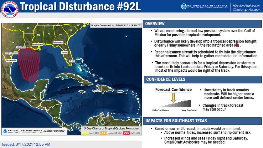
We are monitoring a broad low pressure system over the Gulf of Mexico for possible tropical development.
Disturbance will likely develop into a tropical depression tonight or early Friday somewhere in the red hatched area.
Reconnaissance aircraft is scheduled to fly into the disturbance this afternoon. This will help to gather more detailed information.
The most likely scenario is for a tropical depression or storm to track north into Louisiana late Friday or Saturday. For this system, most of the impacts would be right of the track.
Impacts for Southeast Texas
Based on current forecast, impacts would be minimal:
• Above normal tides, increased surf and rip current risk.
• Increased winds and seas Friday and Saturday. Small Craft advisories may be needed.