- Sections :
- Crime & Public Safety
- Restaurants & Food
- Sports
- More
Categories
UPDATE: Thursday, January 8, 2015
An update from the National Weather Service...
Winter precipitation possible late Thursday night into Friday morning, and again late Friday night into Saturday morning. The approach of several distrubances will increase area rain chances heading into this weekend at a time when surface temperatures are near freezing. Any precipitation that falls when temperatures are below freezing will fall as freezing rain.
The best chances for freezing rain are late Thursday night into Friday are along and north of a Caldwell to Livingston line. The best chances for freezing rain late Friday night into Saturday morning are along and north of an Edna to Columbus, to Caldwell to Livingston line.
Most rain will occur during the warmer parts of the day when temperatures are above freezing. Main impacts from freezing rain will primarily occur over elevated surfaces like bridges and overpasses.
UPDATE:
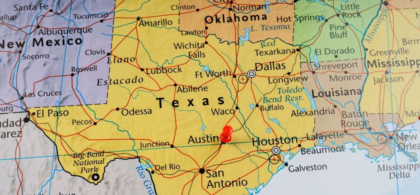
MONTGOMERY COUNTY, Texas -- Special Weather Statement from the National Weather Service...
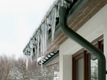
A very cold air mass is expected Wednesday night, and Thursday morning an arctic cold front will move across southeast Texas.
Breezy north winds and very cold temperatures will settle over the region Wednesday night. A hard freeze watch has been issued for temperatures falling into the upper teens to lower 20s, along and north of a line from Somerville to New Waverly, and over to Livingston, between midnight Wednesday and mid-Thursday morning.
To the south of these locations, temperatures may fall to below freezing, even along the immediate coast. Due to winds gusting from between 15 to 25 miles per hour, wind chills will likely lower into the teens for most of the inland counties Wednesday night and early Thursday morning. A windchill advisory may be issued for Wednesday night and Thursday morning.
ORIGINAL STORY:
MONTGOMERY COUNTY, Texas -- The week’s weather at a glance...the new year is being ushered in with cold weather in the low 30s on Monday, but the wind chill will make the temperature feel like it's in the 20s, but a colder front will arrive Thursday evening.
The temperature will remain constant through the early part of the week with the highs in the high 40s to low 50s during the day, and dropping to the low 30s at night until Thursday evening.
The first really cold ‘cold front’ will come in Thursday night with temperatures dropping into the high 20s. With the front will come precipitation on Friday and continue through the weekend with a 40 percent chance of rain.
Take the next couple of days to ‘winterize’ your home by wrapping outdoor, exposed pipes, protecting tender vegetation, and making preparations for pets to be indoors out of the weather. If you haven’t had your furnace checked this winter, it’s advisable to do this early this week.
Freezing rain possible, and can impact elevated surfaces.
An update from the National Weather Service...
Winter precipitation possible late Thursday night into Friday morning, and again late Friday night into Saturday morning. The approach of several distrubances will increase area rain chances heading into this weekend at a time when surface temperatures are near freezing. Any precipitation that falls when temperatures are below freezing will fall as freezing rain.
The best chances for freezing rain are late Thursday night into Friday are along and north of a Caldwell to Livingston line. The best chances for freezing rain late Friday night into Saturday morning are along and north of an Edna to Columbus, to Caldwell to Livingston line.
Most rain will occur during the warmer parts of the day when temperatures are above freezing. Main impacts from freezing rain will primarily occur over elevated surfaces like bridges and overpasses.
UPDATE:
MONTGOMERY COUNTY, Texas -- Special Weather Statement from the National Weather Service...
A very cold air mass is expected Wednesday night, and Thursday morning an arctic cold front will move across southeast Texas.
Breezy north winds and very cold temperatures will settle over the region Wednesday night. A hard freeze watch has been issued for temperatures falling into the upper teens to lower 20s, along and north of a line from Somerville to New Waverly, and over to Livingston, between midnight Wednesday and mid-Thursday morning.
To the south of these locations, temperatures may fall to below freezing, even along the immediate coast. Due to winds gusting from between 15 to 25 miles per hour, wind chills will likely lower into the teens for most of the inland counties Wednesday night and early Thursday morning. A windchill advisory may be issued for Wednesday night and Thursday morning.
ORIGINAL STORY:
MONTGOMERY COUNTY, Texas -- The week’s weather at a glance...the new year is being ushered in with cold weather in the low 30s on Monday, but the wind chill will make the temperature feel like it's in the 20s, but a colder front will arrive Thursday evening.
The temperature will remain constant through the early part of the week with the highs in the high 40s to low 50s during the day, and dropping to the low 30s at night until Thursday evening.
The first really cold ‘cold front’ will come in Thursday night with temperatures dropping into the high 20s. With the front will come precipitation on Friday and continue through the weekend with a 40 percent chance of rain.
Take the next couple of days to ‘winterize’ your home by wrapping outdoor, exposed pipes, protecting tender vegetation, and making preparations for pets to be indoors out of the weather. If you haven’t had your furnace checked this winter, it’s advisable to do this early this week.
Comments •

More From: (16520)
Texas Workforce Commission Reemployment Program receives national award
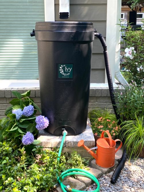
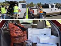
LSGCD is offering discounted rainwater harvesting kits for Rain for Tomorrow Conservation Initiative
Texas voters to decide on a combined 23 non-binding advisory questions in the March 3 primaries

Bob Harvey responds to 'false online claims,' reaffirms commitment to Precinct 2 voters

Shot Through the Heart - The Crooks to Blame. Crooks Give Love a Bad Name.

Nick’s Local Eats Celebrates 2025 Year End Awards

Texas Workforce Commission Welcomes New Executive Director Steve Pier

Conroe EDC Praises Hospitality, Generosity of Joe's Italian Restaurant's Holiday Meal Distribution
For the 70th year, NORAD will track Santa for your kiddos this Christmas Eve

Building Confidence Through Structure

Texas Pink Playbook Hosts Sold-Out Elvis Presley–Themed Event as It Emerges as One of Texas’ Fastest

A Lifetime of Accountability: Offender to Serve 75-Year Day-for-Day Sentence