- Sections :
- Crime & Public Safety
- Restaurants & Food
- Sports
- More
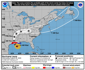
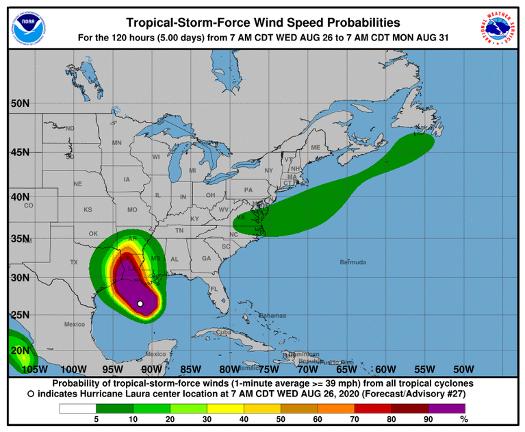
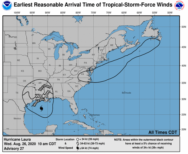
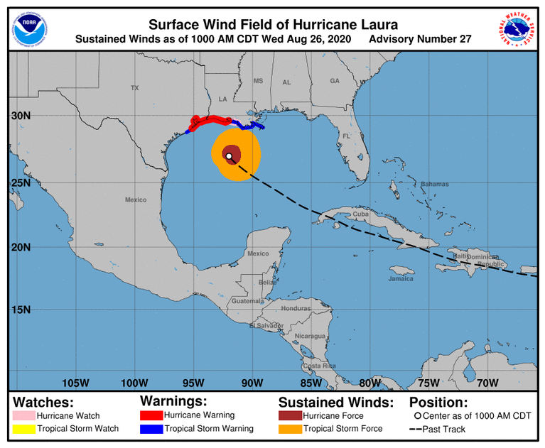
THE WOODLANDS, TX - Hurricane Laura continues to strengthen, as of the 10AM advisory. The storm is currently moving in a NW direction at 16 MPH with maximum sustained winds of 125 MPH.
Unsurvivable storm surge with large and destructive waves will cause catastrophic damage from Sea Rim State Park in Texas to Intracostal City in Louisiana, including Calcasieu and Sabine Lakes. This surge could penetrate up to 30 miles inland from the immediate coastline. Only a few hours remain to protect life and property and all actions should be rushed to completion.
Hurricane-force winds are expected tonight in portions of the hurricane warning area from San Luis Pass in Texas to west of Morgan City in Louisiana, with catastrophic wind damage expected where Laura's eyewall makes landfall. Hurricane-force winds and widespread damaging wind gusts will spread well inland across portions of Eastern Texas and Western Louisiana early Thursday.
Widespread flash flooding along small streams, urban areas, and roadways is expected to begin this afternoon into Thursday from eastern Texas, across Louisiana and Arkansas. This will also lead to minor to isolated moderate freshwater river flooding. The heavy rainfall threat and localized flash and urban flooding potential will spread northwestward into the middle-Mississippi, lower Ohio and Tennessee Valleys Friday and Saturday.
Stay with Woodlands Online for continued updates on Hurricane Laura.