- Sections :
- Crime & Public Safety
- Restaurants & Food
- Sports
- More
Categories
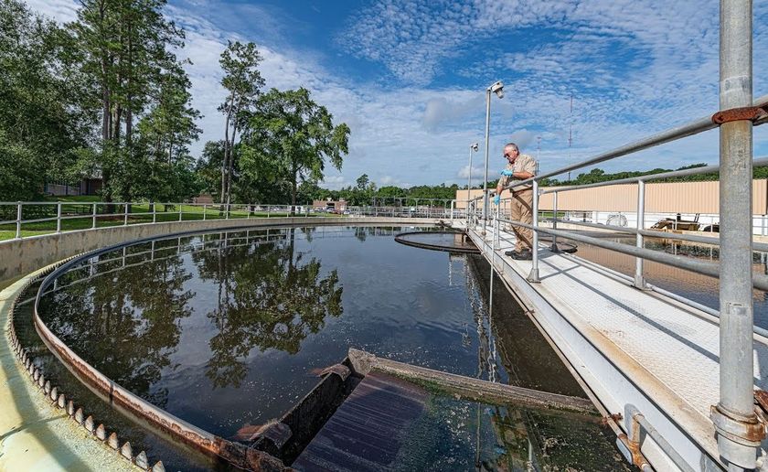
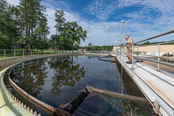
SJRA Partners with Other Organizations about San Jacinto River Watershed Plan

HARRIS COUNTY, Texas - Harris County, the lead agency on the grant, received a State Award letter in the amount of $2,708,208.00 (Federal $2,031,156.00 | Local $677,052.00) from the Texas Division of Emergency Management to provide necessary funding from the Federal Emergency Management Agency to complete a comprehensive San Jacinto Watershed Master Drainage Plan. The local match cost will be shared between Montgomery County, Harris County, the San Jacinto River Authority (SJRA), and City of Houston.
As the representative for Harris County, Harris County Flood Control District will work alongside the SJRA, Montgomery County, and the City of Houston to develop a comprehensive set of models for the entire Upper San Jacinto River watershed (including its major tributaries, from the headwaters in Walker County to the Interstate 10 crossing at the San Jacinto River in Harris County.) The models will use consistent, cohesive methodology and rainfall rates regardless of the county in which those channels are located. The study is expected to complete on or before January 2022, which will include community engagement meetings to gather public input and comments to further refine the study results.
The results of the San Jacinto Watershed Master Drainage Plan will be used to update the Montgomery County Mitigation Plan and to identify future flood mitigation projects that can be implemented in the near- and long-term to reduce flood risk to people and property. Other participating communities may also incorporate the results in updates to their Hazard Mitigation Plans and use for guidance on regulations for future growth within the study area. Information to be developed includes inundation maps for the studied streams that show the extent and depth of riverine flooding for an array of simulated storm events. Additionally, information will be gathered about the number of structures, acres of land, parcels, and miles of roadway that are located within the modeled floodplains. Although results from the study may be utilized in the future, this project is independent of the Federal Emergency Management Agency’s Flood Insurance Rate Map process.
This project will establish existing watershed conditions and analyze current flooding risks and vulnerabilities necessitating mitigation projects that may include large regional detention facilities, channel conveyance improvements, vegetation and sediment management activities, property buy- outs, and recommendations for additional gages at appropriate locations throughout the Upper San Jacinto River Watershed. The project will prioritize flood risk reduction strategies, quantify the mitigation implementation costs, and develop information to help improve public awareness of flood hazards along the major tributaries. The ongoing work undertaken by the U.S. Army Corps of Engineers with respect to sediment transport and long-term management activities will be incorporated into this study as well.
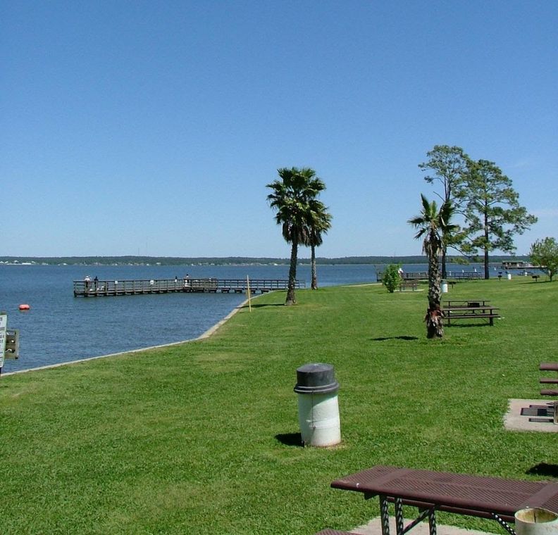
The streams to be studied are located in seven different counties (Harris, Montgomery, Liberty, San Jacinto, Walker, Grimes, and Waller), covering an expanse of roughly 3,000 square miles within the study area. The stream length totals approximately 535 miles and includes West Fork San Jacinto River, East Fork San Jacinto River, San Jacinto River, Lake Creek, Cypress Creek, Little Cypress Creek, Spring Creek, Willow Creek, Caney Creek, Peach Creek, Luce Bayou, Tarkington Bayou, and Jackson Bayou.
As the representative for Harris County, Harris County Flood Control District will work alongside the SJRA, Montgomery County, and the City of Houston to develop a comprehensive set of models for the entire Upper San Jacinto River watershed (including its major tributaries, from the headwaters in Walker County to the Interstate 10 crossing at the San Jacinto River in Harris County.) The models will use consistent, cohesive methodology and rainfall rates regardless of the county in which those channels are located. The study is expected to complete on or before January 2022, which will include community engagement meetings to gather public input and comments to further refine the study results.
The results of the San Jacinto Watershed Master Drainage Plan will be used to update the Montgomery County Mitigation Plan and to identify future flood mitigation projects that can be implemented in the near- and long-term to reduce flood risk to people and property. Other participating communities may also incorporate the results in updates to their Hazard Mitigation Plans and use for guidance on regulations for future growth within the study area. Information to be developed includes inundation maps for the studied streams that show the extent and depth of riverine flooding for an array of simulated storm events. Additionally, information will be gathered about the number of structures, acres of land, parcels, and miles of roadway that are located within the modeled floodplains. Although results from the study may be utilized in the future, this project is independent of the Federal Emergency Management Agency’s Flood Insurance Rate Map process.
This project will establish existing watershed conditions and analyze current flooding risks and vulnerabilities necessitating mitigation projects that may include large regional detention facilities, channel conveyance improvements, vegetation and sediment management activities, property buy- outs, and recommendations for additional gages at appropriate locations throughout the Upper San Jacinto River Watershed. The project will prioritize flood risk reduction strategies, quantify the mitigation implementation costs, and develop information to help improve public awareness of flood hazards along the major tributaries. The ongoing work undertaken by the U.S. Army Corps of Engineers with respect to sediment transport and long-term management activities will be incorporated into this study as well.
The streams to be studied are located in seven different counties (Harris, Montgomery, Liberty, San Jacinto, Walker, Grimes, and Waller), covering an expanse of roughly 3,000 square miles within the study area. The stream length totals approximately 535 miles and includes West Fork San Jacinto River, East Fork San Jacinto River, San Jacinto River, Lake Creek, Cypress Creek, Little Cypress Creek, Spring Creek, Willow Creek, Caney Creek, Peach Creek, Luce Bayou, Tarkington Bayou, and Jackson Bayou.
Comments •

More From: San Jacinto River Authority - Woodlands Division (75)

Kill the curbside: San Jacinto River Authority wants to recycle your Christmas tree
San Jacinto River Authority keeps you updated with its online Project Viewer

Happy 52nd Birthday to Lake Conroe!
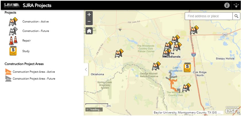
Keep tabs on water projects, issues, and repairs with the SJRA Project Viewer
Lake Conroe Park to reopen with updated amenities and theme

Lone Star Groundwater Conservation District Technical Consultants attend SJRA GRP Review Committee Meeting
San Jacinto River Authority’s Woodlands Division wraps up 2024 with multiple projects underway
SJRA requests innovative approaches for the operation of Lake Conroe Park

Wholesale water rate reductions go into effect Sept. 1
SJRA approves a reduction in wholesale water rates
SJRA announces Board of Directors meeting for August 22
SJRA approves a reduction in wholesale water rates