- Categories :
- More
Special Weather Statement issued February 14 at 5:10PM CST
By:
![]() Woodlands Online
| Published 02/14/2026
Woodlands Online
| Published 02/14/2026
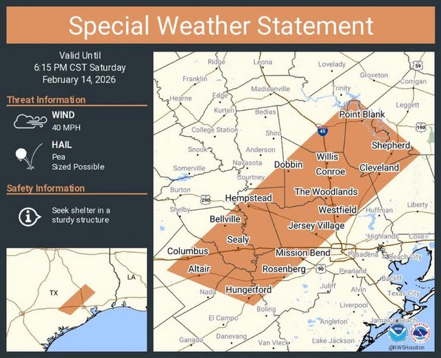
At 509 PM CST, Doppler radar was tracking strong thunderstorms along a line extending from New Waverly to near Eagle Lake. Movement was east at around 60 mph. HAZARD...Wind gusts up to 40 mph and pea size hail. SOURCE...Radar indicated. IMPACT...Gusty winds could knock down tree limbs and blow around unsecured objects. Minor hail damage to vegetation is possible. Locations impacted include... Conroe, southeastern Huntsville, western Rosenberg, Katy, Richmond, Tomball, Cleveland, Jersey Village, Sealy, Hempstead, Willis, Prairie View, Brookshire, Bellville, Columbus, Eagle Lake, Pinehurst, Spring Branch North, The Woodlands, and Greater Greenspoint.