- Categories :
- More
Winter Storm Watch issued January 21 at 1:18PM CST until January 25 at 6:00PM CST
By:
![]() Woodlands Online
| Published 01/21/2026
Woodlands Online
| Published 01/21/2026
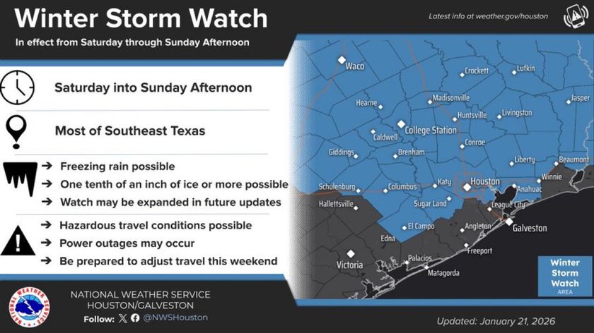
WHAT...Heavy mixed precipitation possible. Total ice accumulations between one tenth and three tenths of an inch possible across the entire watch area, with the highest accumulations in the Piney Woods and Brazos Valley. Slight sleet accumulations will be possible in the northern Piney Woods and Brazos Valley, but the primary concern will be freezing rain. * WHERE...A portion of southeast Texas. * WHEN...From Saturday morning through Sunday afternoon. * IMPACTS...Power outages and tree damage are possible due to the ice. Travel could be hazardous. * ADDITIONAL DETAILS...Rain will change over to freezing rain and sleet in the Piney Woods and Brazos Valley as early as early Saturday morning. Elsewhere, rain may change over to freezing rain as early as Saturday afternoon or Saturday night.