- Categories :
- More
Tropical Weather Outlook
By:
![]() Woodlands Online
| Published 07/23/2025
Woodlands Online
| Published 07/23/2025
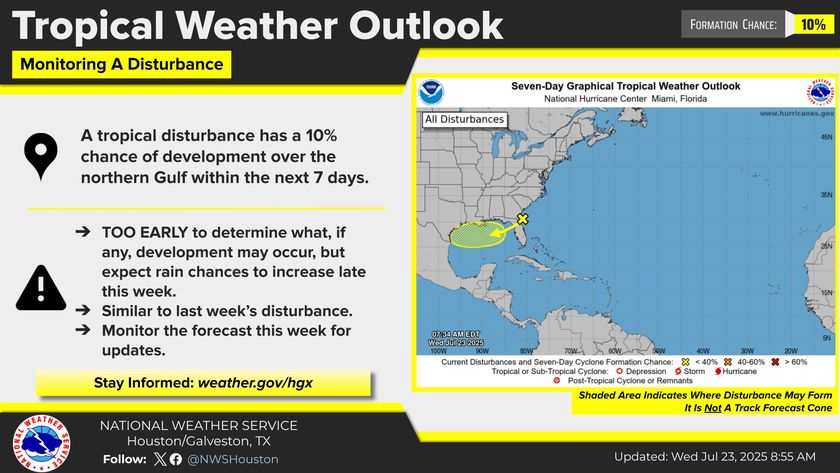
The National Hurricane Center (NHC) is keeping a close eye on a developing area of low pressure located just off the east coast of Florida. This disturbance, currently producing disorganized showers and thunderstorms, is being monitored for any signs of tropical development.
Low Chance of Organization
As the system drifts westward over the Gulf of Mexico later this week, most weather models suggest it will remain a broad and weak area of low pressure. At present, the NHC gives it only a 10% chance of further organization over the next few days. The expected movement inland toward the end of the week will likely limit its ability to strengthen.
However, given the unpredictable nature of tropical systems, the NHC has included a low possibility of development over the Gulf. To gather more accurate data, NOAA’s Hurricane Reconnaissance Aircraft is scheduled to conduct an invest mission on Thursday, July 24, 2025, at 1:00 PM CDT.
Impacts to Southeast Texas
Even if this system fails to become a tropical cyclone, it will bring increasing rain chances and thunderstorms to Southeast Texas, beginning as early as Thursday evening and persisting into the weekend. Residents should prepare for periods of heavy rain and possible localized flooding.
Stay Weather-Aware
We are now in the heart of hurricane season, making it essential to stay informed about any potential developments in the tropics. Continue monitoring updates from the NHC and local forecasts as this system evolves.


