- Categories :
- More
WEATHER ALERT - Batten down the hatches
By:
![]() Woodlands Online
| Published 08/04/2025
Woodlands Online
| Published 08/04/2025
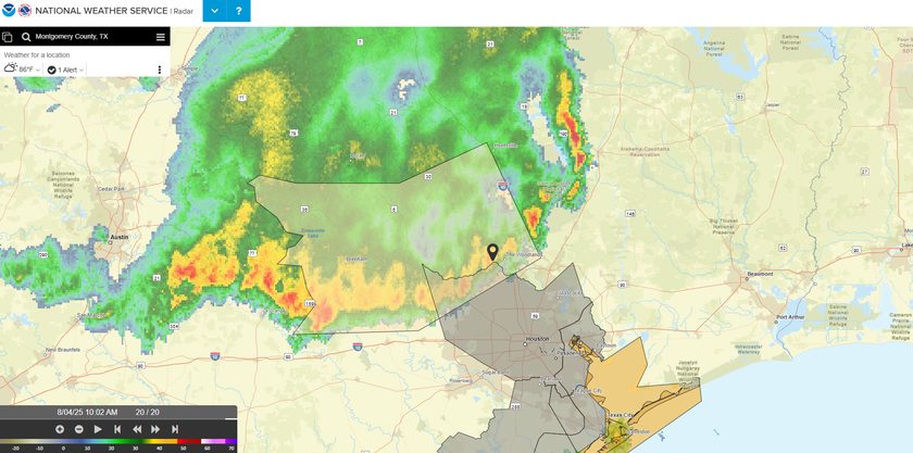
If looking out the window didn't already tell you, there's some storming happening throughout The Woodlands, and the rains will remain heavy for the next couple of hours. The National Weather Service has issued a Special Weather Statement:
At 924 AM CDT, Doppler radar was tracking strong thunderstorms along a line extending from 7 miles south of Washington to near Burton to near Elgin. Movement was south at 40 mph.
HAZARD...Wind gusts up to 50 mph.
SOURCE...Radar indicated.
IMPACT...Gusty winds could knock down tree limbs and blow around unsecured objects.
Locations impacted include...
Southern College Station, Conroe, Huntsville, Brenham, Tomball, Navasota, Hempstead, Willis, Prairie View, Caldwell, Bellville, Pinehurst, The Woodlands, Washington, Shelby, Hockley, Oak Ridge North, Waller, Panorama Village, and Shenandoah.
Instructions
If outdoors, consider seeking shelter inside a building.


